

Surveying & Mapping Solution in Bangladesh
- Published in Services
- Aug 10, 2024
- 7.21 Min

Surveying and Mapping refers to the measurement, collection, and mapping of the shape, size, spatial position, and attributes of natural geographical elements or artificial facilities on the surface.
Surveying is the science, technique, and profession of determining the terrestrial or three-dimensional positions of points and the distances and angles between them.
Mapping, on the other hand, involves creating visual representations of spatial information, usually in the form of maps, charts, and plans.
According to international standards, surveying and mapping must adhere to specific accuracy, precision, and data quality guidelines. These standards ensure that the data collected is reliable and can be used for various applications with confidence.
The global surveying and mapping services market reached a valuation of US $ 9 billion in 2021 and is expected to further evolve at a CAGR of 3.4% to end up at US $ 13 billion in 2032.

Figure 01: Surveying and Mapping
Technologies Used for Surveying and Mapping
The field of surveying and mapping has seen significant technological advancements over the years. Here are some of the key technologies used:

Nowadays, surveying and measurement technology is combined with cloud computing processing technology and Internet of Things (IoT) technology. It provides basic data and application support for the construction of a smart city, making the city construction more and more intelligent.
At present technological advancements drive national progress, and surveying and mapping are foundational to infrastructure development, urban planning, environmental management, Resource Management, Disaster Planning, and more.
As Bangladesh moves towards its Vision 2041 of becoming a Smart Bangladesh, sustainability and quality assurance become paramount. To achieve sustainable growth, rigorous testing and verification are essential, necessitating the latest surveying and mapping technologies in Bangladesh.
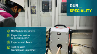
At Iconic Engineering, we are committed to delivering state-of-the-art surveying and mapping services in Bangladesh. By leveraging cutting-edge technology, skilled manpower, and internationally recognized methods, we provide comprehensive solutions that meet global standards. Our services include 3D scanning and imaging, flatness mapping, cartography, GIS mapping, and UAV survey solutions.
When and How Should Surveying and Mapping Be Used
When to Use Surveying and Mapping:
- Project Initiation: Before starting any construction or development project to gather accurate site data.
- Urban Planning: For designing and managing urban infrastructure and services.
- Environmental Assessments: To monitor and manage natural resources and assess environmental impact.
- Agricultural Planning: To optimize land use and monitor crop health.
- Disaster Preparedness: For planning and responding to natural disasters.
How to Use Surveying and Mapping:
- Define Objectives: Clearly outline the purpose and scope of the surveying and mapping project.
- Choose Appropriate Technology: Select the right tools and technologies based on the project requirements.
- Conduct Surveys: Perform field surveys using calibrated equipment to collect accurate data.
- Process Data: Analyze and process the collected data using specialized software.
- Create Maps and Models: Generate detailed maps, charts, and 3D models to visualize the data.
- Verify and Validate: Ensure the accuracy and reliability of the final output through rigorous testing and quality control measures.
At Iconic Engineering, we provide expert guidance and services to ensure that surveying and mapping are used effectively to achieve the best outcomes for your projects.
Comparison Between the Worldwide Market of Surveying and Mapping and Bangladesh Market and Practice:
The global geospatial analytics market was valued at around $53.54 billion in 2022 and is projected to reach $107.8 billion by 2030, growing at a CAGR of 9.6% from 2023 to 2030. This growth is driven by increased demand for geospatial data across various industries, technological advancements, and the rising adoption of geospatial analytics for decision-making.
Bangladesh's government also taking the initiative in various sectors, including infrastructure, urban planning, agriculture, disaster management, and environmental monitoring. Bangladesh Space Research and Remote Sensing Organization (SPARRSO), Infrastructure Development Projects, Disaster Management, and Climate Change Adaptation are the Key Projects and Investments.
World Bank and Asian Development Bank (ADB), The United Nations Development Programme (UNDP), and the Food and Agriculture Organization (FAO) support projects in Bangladesh.

To bridge the gap between global practices and the local market, At Iconic Engineering, we are committed to driving the adoption of advanced surveying and mapping technologies in Bangladesh.
By leveraging global technology through our local experts, we aim to support the country's vision of becoming a Smart Bangladesh by 2041. Our expertise and dedication to quality ensure that we provide reliable and accurate surveying and mapping services, contributing to sustainable development and informed decision-making.
3D Scanning and Imaging
What is 3D Laser Scanning and Imaging
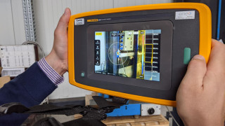
3D scanning and imaging involve capturing the physical characteristics of an object or environment in three dimensions using laser scanners and photogrammetry. This method allows for the creation of highly detailed and accurate models of real-world structures.

Application Areas of 3D Scanning and Imaging


Figure: Accident Investigation

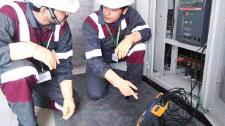
Figure: Scanning of an Infrastructure using a 3D Laser Scanner
Global Practices vs. Bangladesh Scenario
Globally, 3D scanning is widely adopted for its precision and efficiency. In Bangladesh, while still emerging, Iconic Engineering is at the forefront, utilizing the latest 3D scanning technologies to deliver unparalleled accuracy in various projects. This technology is critical for achieving the meticulous detail required in modern construction and heritage preservation efforts.
Test Procedures:
- Equipment Calibration: Ensuring all scanners are calibrated for accuracy.
- Multi-Angle Scans: Capturing data from various angles to ensure comprehensive coverage.
- Data Post-Processing: Using software to create detailed 3D models from the collected data.
At Iconic Engineering, we leverage state-of-the-art Laser 3D scanning technology to deliver precise and detailed digital representations that support innovation, preservation, and efficiency in projects across Bangladesh. Whether it's in architecture, healthcare, manufacturing, or cultural heritage, our commitment to quality ensures that we meet the highest standards of accuracy and reliability, contributing to the advancement of various fields and the realization of a Smart Bangladesh.
Drone Survey & Solution
What is a Drone Survey & Solution
Unmanned Aerial Vehicles (UAVs) also known as Drones, have transformed the surveying and mapping industry with their ability to capture high-resolution aerial imagery and precise data quickly and efficiently. There are three major parts such as:
1. Platform: Platforms are deployed on various platforms designed to meet specific surveying and mapping requirements. These platforms are categorized based on their design, capabilities, and application areas. Some common Platforms are Multi-Rotor Drones, Fixed-Wing Drones, Hybrid VTOL Drones, Single-Rotor Drones, Fixed-Wing VTOL Drones, and so on.
2. Payload: Payload refers to the additional sensor or material a drone can carry beyond its essential components. Types of Drone Payloads are:
- Cameras and Imaging Sensors: LiDAR Sensors, Thermal Imager, Multispectral Cameras, Photographic Cameras.
- Surveying and Mapping Equipment: GPS and GNSS Receivers, 3D Scanners.
- Scientific Instruments: Air Quality Sensors, Radiation Detectors.
- Delivery Mechanisms: Cargo Baskets or Pods, Medical Supplies.
- Communication and Networking Equipment: Relay Stations, Signal Boosters.
3. Software: UAVs require sophisticated software to plan missions, control flights, process data, and generate actionable insights. These software solutions range from flight planning and control applications to advanced data processing and analysis tools

Application Areas of UAV Survey


Global Practices vs. Bangladesh Scenario
Globally, drone surveys are revolutionizing data collection. In Bangladesh, Iconic Engineering leads the way by incorporating the latest drone technologies to provide high-resolution aerial data and innovative solutions. Drone surveys are instrumental in achieving the Smart Bangladesh vision by enabling efficient and precise data collection for various applications.
Test Procedures:
- Pre-Flight Planning: Conducting thorough planning and equipment checks before each flight.
- Systematic Aerial Surveys: Executing systematic flight patterns to ensure comprehensive data capture.
- Data Processing: Analyzing captured data using advanced software to generate actionable insights.
Iconic Engineering’s team of skilled drone operators ensures each survey is executed with precision, adhering to international safety and quality standards. Our drone solutions provide the necessary data for informed decision-making and sustainable growth.
Flatness Mapping
What is Flatness Mapping
Flatness mapping measures and documents the flatness and levelness of surfaces, crucial for ensuring quality and safety in construction projects. It involves measuring deviations from a perfectly flat plane and is crucial in industries where surface quality and precision are critical. Here are some of the key application areas where flatness mapping is widely utilized.

Global Practices vs Bangladesh Scenario:
Internationally, flatness mapping is a standard practice in construction. In Bangladesh, Iconic Engineering sets the benchmark by employing advanced flatness mapping technologies to guarantee the highest standards in surface quality. This practice is vital for infrastructure projects aimed at supporting the Smart Bangladesh vision.
Test Procedures:
- Laser Levels and Digital Levels: Using precision 3D Laser Scanner to measure surface deviations by setting a standard reference points.
- Scan the Area: Conducting surveys at the required area to monitor surface changes.
- Data Analysis: Identifying and rectifying deviations through detailed analysis.
Flatness mapping plays a critical role in ensuring the precision, quality, and functionality of surfaces in various industries. At Iconic Engineering, we utilize advanced flatness mapping techniques to deliver accurate assessments and solutions that meet the stringent requirements of our clients in Bangladesh. Whether in manufacturing, Roads and highway aerospace, automotive, construction, or electronics, our commitment to excellence ensures that surfaces meet the highest standards of flatness, contributing to efficiency, safety, and reliability in diverse applications.
Mapping and Cartography
What is Mapping and Cartography
Mapping is the process of creating visual representations of spatial data, depicting geographical features, boundaries, and relationships between objects. Cartography, a subset of mapping, focuses on the art and science of mapmaking. It involves designing and producing maps that are accurate, informative, and visually appealing.
Mapping and cartography involve creating visual representations of geographical areas, incorporating topographic and thematic elements to support various planning and management activities.

Applications of Mapping and Cartography
- Urban Planning: Assisting in the design and management of urban spaces.
- Environmental Management: Monitoring natural resources and environmental changes.
- Transportation Networks: Planning and managing transportation infrastructure.
- Disaster Management: Preparing for and responding to natural disasters.
Global Practices vs. Bangladesh Scenario:
Globally, Mapping and Cartography are integral to planning and development. In Bangladesh, Iconic Engineering leverages state-of-the-art GIS and cartographic techniques to provide detailed and accurate maps for various applications. These maps are essential for the planning and implementation of the Smart Bangladesh initiative.
Test Procedures:
- Field Data Collection: Using GPS and total stations to gather accurate geographical data.
- Data Integration: Combining data from multiple sources using GIS software.
- Quality Assurance: Cross-referencing with existing data to ensure accuracy.
Iconic Engineering skilled cartographers ensure that all maps are created to the highest standards, aiding in effective planning and decision-making, which is crucial for sustainable urban development in Bangladesh.
GIS Mapping
What is GIS Mapping
Geographic Information Systems (GIS) mapping involves the use of software to capture, store, analyze, and visualize spatial and geographic data, providing critical insights for various applications.
Application Areas:
- Resource Management: Managing natural resources effectively.
- Infrastructure Development: Planning and monitoring infrastructure projects.
- Public Health: Tracking disease outbreaks and planning healthcare facilities.
- Land Use Planning: Optimizing land use and zoning decisions.
Global Practices vs. Bangladesh Scenario:
GIS mapping is a global standard for managing spatial data. In Bangladesh, Iconic Engineering utilizes advanced GIS technologies to support diverse projects, ensuring data accuracy and usability. GIS mapping is a cornerstone of the Smart Bangladesh vision, facilitating data-driven decision-making.
Test Procedures:
- Data Collection: Gathering data from various sources, including satellite imagery and field surveys.
- Spatial Analysis: Using GIS software to analyze spatial relationships and patterns.
- Data Validation: Ensuring the accuracy and reliability of GIS data through rigorous validation processes.
As Bangladesh progresses towards its Vision 2041 of becoming a Smart Bangladesh, the importance of advanced surveying and mapping technologies cannot be overstated. At Iconic Engineering, we provide top-tier services that support this vision. By using the latest technologies and methods, we ensure accurate, reliable, and efficient results for all your project needs. Our commitment to quality assurance through regular testing and verification is key to achieving sustainable growth and ensuring the success of the Smart Bangladesh initiative.
Whether it's 3D scanning and imaging, flatness mapping, cartography, GIS mapping, or drone surveys, Iconic Engineering has the expertise and technology to meet your needs. Join us in building a smarter, more sustainable future for Bangladesh.
Share on:

Topics
Related Post

Geophysical Survey In Bangladesh

Surveying & Mapping Solution in Bangladesh

Geotechnical Laboratory Triaxial Testing In Bangladesh
Power Quality Analysis
Annual Inspections Service in Bangladesh
Ultrasound Leak Detection
-Analysis-1687596679.jpg)
Partial Discharge (PD)
Battery Performance Evaluation & Testing

CT-PT Analysis

Drone applications In Bangladesh
Address
Islam Plaza (6th floor), Plot-7,Main Road-3, Pallabi, Mirpur, Dhaka 1216

