Drone applications In Bangladesh
- By Aman Ullah
- Published in Services
- Oct 08, 2024

The drone applications In Bangladesh are rapidly transforming in various sectors, including agriculture, disaster management, and infrastructure development. Drones are used for precision farming, allowing farmers to monitor crop health, optimize irrigation, and apply fertilizers more efficiently. In disaster management, drones aid in damage assessment and deliver relief supplies during floods and cyclones. Additionally, they assist in infrastructure projects by surveying land and monitoring construction sites. As technology evolves, drones are becoming essential tools for enhancing productivity, improving safety, and supporting sustainable development in the country.
What is a Drone/UAV?
UAV stands for "Unmanned Aerial Vehicle,” which is a flying machine without a human pilot on board, often referred to as a drone.
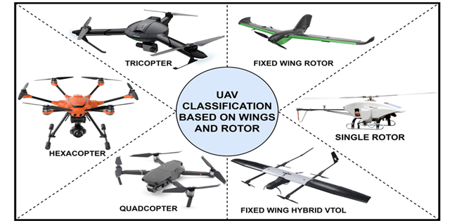
There are two types:
- Multirotor UAVs
- Fixed-wing UAVs.
In recent years, Unmanned Aerial Vehicles (UAVs) or drones have emerged as a revolutionary tool, significantly impacting various sectors in Bangladesh. From agriculture to infrastructure development, these versatile devices are transforming industries by providing accurate data, improving efficiency, and reducing operational costs. Iconic Engineering Ltd., in collaboration with DJI, is at the forefront of introducing advanced drone solutions in Bangladesh, contributing to the country’s technological progress.
UAV Solution Includes:
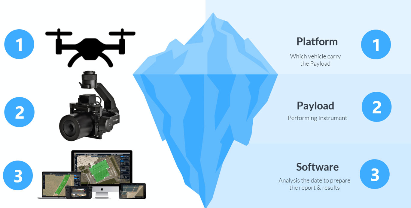
Platform: There are different types of Platforms available, types of platforms are given below
Type of Payloads
There are several types of scanners and sensors that can be attached to UAVs/Drones to capture various types of data for different applications. Here are some common types of scanners and their respective applications:
|
|
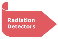
Application: Nuclear site monitoring, radiation safety Description: Radiation detectors measure ionizing radiation levels for safety and environmental assessment |
|
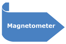
Application: Archaeological surveys, mineral exploration Description: Magnetometers detect variations in the Earth's magnetic field, useful for geophysical investigations |
|
|
|
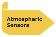
Application: Weather monitoring, atmospheric Description: These sensors measure parameters like temperature, humidity, and pressure for meteorological studies. |
|
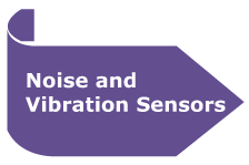
Application: Environmental noise assessment, structural health monitoring Description: These sensors measure noise levels and vibrations in the environment or structures |
|
|
|
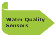
Application: Water quality assessment, environmental monitoring. |
|
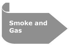
Application: Fire detection and monitoring. Description: Smoke and gas detectors are used for early fire detection and monitoring in specific environments. |
|
|
|
Application: Terrain mapping, 3D modeling, forestry, infrastructure inspection & so on Description: LIDAR uses laser pulses to measure distances and create highly detailed 3D maps and models. |
|
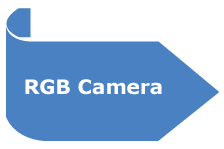
Application: Aerial photography, visual inspection, mapping Description: Standard RGB cameras capture color images and videos for various visual applications |
|
|
|
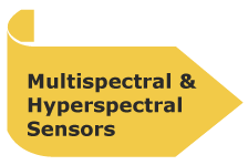
Application: Agriculture (crop health monitoring). environmental assessment Description: These sensors capture data in multiple or narrow spectral bands, enabling the analysis of vegetation health, soil composition, |
|
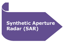
Application: Disaster monitoring, environmental mapping, and subsidence detection. Description: SAR sensors provide high-resolution radar images, even in adverse weather conditions |
|
|
|
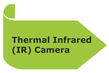
Application: Search and rescue, building inspections, wildlife monitoring. Description: Thermal IR cameras detect temperature variations and are used to identify heat sources or anomalies |
|
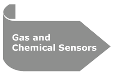
Application: Environmental monitoring, industrial safety, pollutant detection Description: These sensors detect specific gases or chemicals in the air for environmental or safety purposes. |

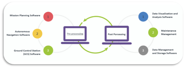
Software
Drone/UAVs rely on various types of software to operate efficiently and effectively. Here are some key types of Drone/UAV technological software:
Worldwide per year cost for the Drone/UAV Sector
The global drone or UAV (Unmanned Aerial Vehicle) market has been experiencing rapid growth and is expected to continue expanding over the coming years. Here's a breakdown of the yearly costs associated with the drone/UAV market:
- Global Drone Market Size
- In 2023, the global drone market was valued at approximately $30 billion.
- By 2030, it is projected to reach nearly $100 billion, growing at a compound annual growth rate (CAGR) of 15-20%.
- Commercial Drone Sector
- The commercial drone market alone was valued at around $14 billion in 2023 and is expected to grow at a CAGR of 25% until 2030. This growth is largely driven by industries such as:
- Agriculture
- Infrastructure
- Logistics
- Surveillance and security
- Media and entertainment
- Energy and utilities
- Annual cost for businesses investing in drones ranges from tens of thousands to millions of dollars depending on scale, including:
- Hardware (drone units)
- Software (data analytics, flight planning)
- Training and operations
- Military and Defense Drones
- The military UAV market is a significant contributor to global drone spending.
- In 2023, defense-related UAV spending amounted to around $20 billion per year globally, including investment in:
- Combat drones
- Surveillance drones
- Tactical drones
- The market is projected to exceed $30 billion annually by 2028.
- Consumer Drones
- The consumer drone market is smaller but growing, with annual spending estimated at around $5 billion in 2023. These are primarily used for recreational purposes, photography, and videography.
- Cost Breakdown per Area of Use
- Agriculture: Drones are used for precision farming, crop monitoring, spraying pesticides, and assessing crop health. The cost per year for this sector globally exceeds $1.5 billion.
- Construction & Infrastructure: Drones help with site surveys, inspections, and progress monitoring. The yearly cost is around $2 billion.
- Logistics: Drones are increasingly being used for parcel delivery and supply chain monitoring. The market for logistics drones is growing, with an estimated $1 billion in spending by 2025.
- Energy & Utilities: Drones are essential for pipeline inspection, wind turbine monitoring, and solar farm assessments. Annual costs are estimated at $2 billion for this sector.
- Insurance and Regulations
- Drone insurance, compliance with local regulations, and certifications also represent significant annual costs for companies, contributing hundreds of millions to global expenditures.
These costs and projections reflect a rapidly evolving industry, with continuous technological advancements and broader applications expected to drive future growth.
Worldwide per year cost for Drone/UAV area in Bangladesh
The drone/UAV market in Bangladesh is still in its developing stages but is experiencing rapid growth as more sectors adopt this technology. Here's an overview of the annual costs and market potential of drones in Bangladesh:
- Bangladesh Drone Market Size
- In 2023, the drone market in Bangladesh was estimated to be valued at around $10-20 million, with significant growth projected due to expanding adoption in agriculture, infrastructure, and disaster management.
- By 2030, this market could grow to more than $100 million, as demand increases across various industries.
- Industry-Specific Drone Usage Costs in Bangladesh
- Agriculture: Agriculture is a key sector in Bangladesh, where drones are increasingly used for precision farming, soil analysis, and crop health monitoring. Annual spending on drone technology in the agricultural sector is estimated at around $3-5 million.
- Infrastructure & Construction: With Bangladesh undergoing massive infrastructure development (e.g., bridges, highways), drones are used for surveying, mapping, and monitoring construction sites. Annual drone expenditure in this sector is estimated to be $2-4 million.
- Disaster Management: Bangladesh’s vulnerability to floods and cyclones makes drones essential for disaster response, search and rescue, and damage assessment. Drones are increasingly deployed by government agencies and NGOs, costing around $1-2 million annually.
- Energy Sector: Drones are also used for inspecting power grids, pipelines, and renewable energy installations like wind turbines and solar farms. Yearly drone investments in this sector are estimated at $1-2 million.
- Security and Surveillance: Law enforcement agencies and private security firms use drones for surveillance, traffic monitoring, and crime prevention. This sector likely spends around $1-3 million annually.
- Government and Regulatory Spending
- The Bangladesh Civil Aviation Authority (CAAB) has regulations for drone operations, and regulatory compliance costs add to the overall expenditures for businesses and government agencies using UAVs.
- The government is increasingly investing in drones for public safety, urban planning, and environmental monitoring, contributing several million dollars per year.
- Future Market Trends and Growth
- With increasing urbanization, drone-based solutions for smart cities and environmental monitoring are expected to grow. Future government projects could drive significant investments, particularly in:
- Urban planning and development
- Flood monitoring and climate resilience
- It is expected that Bangladesh’s drone market will grow by 20-30% annually in the coming years, driven by technological advancements, increased drone affordability, and broader applications across sectors.
- Summary of Annual Drone Costs in Bangladesh
- Agriculture: $3-5 million
- Infrastructure & Construction: $2-4 million
- Disaster Management: $1-2 million
- Energy & Utilities: $1-2 million
- Security & Surveillance: $1-3 million
- Total Market Size in 2023: $10-20 million
- Projected Market Size by 2030: $100 million+
This growth will be fueled by further integration of drones into critical sectors and the adoption of cutting-edge solutions, such as those offered by DJI, with Iconic Engineering Ltd. leading in facilitating these advancements in Bangladesh.
The Rising Importance of UAVs/Drones in Bangladesh
As Bangladesh moves towards technological modernization, UAVs are becoming essential in multiple industries, offering solutions to challenges that were once labor-intensive and time-consuming. The country's rapid urbanization, coupled with the need for sustainable practices in agriculture, construction, and environmental monitoring, has created a strong demand for drones.
DJI, one of the world’s leading drone manufacturers, is playing a vital role in shaping this transformation. With a range of high-performance drones tailored to specific needs, DJI, through its partnership with Iconic Engineering Ltd., is providing cutting-edge solutions that are driving progress across the nation.
Key UAV Applications in Bangladesh
Agriculture: Precision Farming
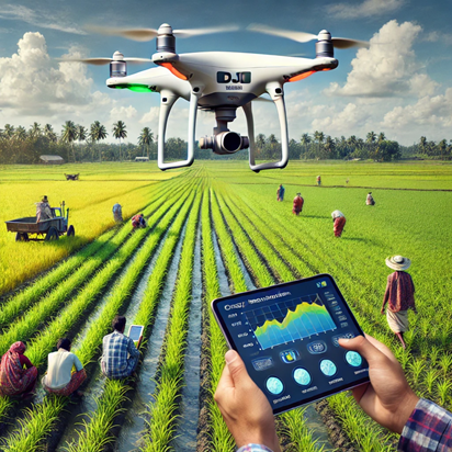
Agriculture is one of the mainstays of Bangladesh’s economy, and drones are reshaping farming practices with precision agriculture. DJI drones equipped with multispectral sensors allow farmers to monitor crop health, analyze soil conditions, and even automate pesticide spraying and spreading. By providing real-time aerial data, farmers can make informed decisions to optimize their yield, reduce input costs, and ensure sustainable farming practices.
Example:
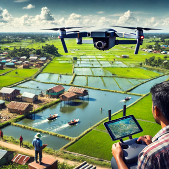
In the northern agricultural hubs, UAVs have been employed to assess water stress levels in rice paddies, leading to more effective water management and healthier crops. The efficiency gained has resulted in increased productivity and lower water wastage. Here’s a real-time image of a DJI drone being used for agricultural applications in Bangladesh.
Surveying and Mapping: Accurate and Time-Saving
Surveying and mapping using UAVs are revolutionizing industries such as construction, urban planning, and infrastructure development. Traditional land surveys often require substantial manpower and time, but with DJI drones, accurate topographic and bathymetric surveys and 3D models can be generated in a fraction of the time.
Example:
In major infrastructure projects like the Padma Bridge and Dhaka metro rail construction, drones have been used to survey hard-to-reach areas, ensuring precision in engineering designs while minimizing risks to surveyors.
Drones, particularly equipped with advanced sensors and cameras, have transformed the way topographic and bathymetric surveys are conducted. Here’s how they are applied:
- Topographic Survey:
- Data Collection: Drones equipped with LiDAR sensors or high-resolution cameras can capture accurate elevation data and surface contours. They create 3D models of the terrain by generating dense point clouds or images.
- Orthomosaic Mapping: Drones take a series of overlapping photographs, which are then stitched together using photogrammetry to create a detailed, georeferenced map known as an orthomosaic map.
- Digital Elevation Models (DEM): The data gathered allows the creation of DEMs, which can be used for land assessment, urban planning, infrastructure development, and environmental monitoring.
- Real-time Data: Many drones can stream data back to operators in real-time, allowing for immediate adjustments and feedback on the survey's progress.
- Bathymetric Survey:
- Bathymetric LiDAR: Drones equipped with Bathymetric LiDAR (green lasers) can measure the depth of water bodies. This technology is useful for mapping underwater terrains, assessing riverbeds, and coastal regions.
- Sonar Systems: For more accurate underwater mapping, drones can carry sonar systems, though these are often hybrid UAV/boat systems. The drone flies over, while the boat surveys the water depth and provides data to the operator in real-time.
- Applications: Bathymetric drones are used for monitoring water resources, ensuring navigability, harbor construction, flood analysis, and environmental conservation efforts.
- Real-Time Picture and Data Integration:
- Real-Time Imaging: Drones with real-time transmission (RTK-enabled systems) provide live video and sensor feedback. Operators can view the terrain and bathymetric data as it’s collected.
- Data Analysis: Combined with AI and data processing software, real-time images can be immediately analyzed, allowing for instant decisions on survey corrections or additional passes.
- GIS Integration: Data can be fed directly into Geographic Information Systems (GIS) for real-time mapping, analysis, and decision-making.
These technologies are highly efficient, cost-effective, and reduce human effort, making them ideal for large-scale surveys or hard-to-reach locations.
Application of Drones in the Power Utility Sector
Drones have a wide range of applications in the power utility sector, helping to improve operational efficiency, safety, and reliability. Here’s how drones are utilized in various aspects of power utility management:
- Power Line Inspection and Maintenance
- Transmission Line Monitoring: Drones equipped with high-resolution cameras and thermal imaging sensors can inspect transmission and distribution lines for damage, corrosion, or vegetation encroachment. They can quickly identify issues like broken conductors, damaged insulators, or overheating components.
- Fault Detection: Drones can detect faults in power lines, such as loose connections or hot spots, using infrared and ultraviolet sensors. This enables quick repairs and reduces power outages.
- Preventive Maintenance: By capturing real-time data and images, drones allow utility companies to conduct preventive maintenance and avoid costly failures or unplanned downtime.
- Substation Inspection
- Routine Inspections: Drones can inspect electrical substations, including transformers, circuit breakers, and switchgear, without shutting down operations. This reduces the risk to workers and minimizes downtime.
- Thermal Imaging: Drones equipped with thermal cameras can identify overheating components and potential points of failure. This helps with early detection of issues, improving asset reliability, and extending the lifespan of critical infrastructure.
Disaster Management and Relief: Quick Response and Assessment
Given Bangladesh’s vulnerability to natural disasters like floods, cyclones, and landslides, UAVs have become an indispensable tool in disaster management. DJI drones can swiftly assess damage, locate stranded victims, and deliver real-time imagery to disaster response teams. This quick response mechanism helps save lives and provides essential data for relief efforts.
Example:
During the floods of 2022, drones were deployed to assess the extent of damage to riverbanks and settlements, enabling authorities to better coordinate relief distribution and repair efforts.
Environmental Monitoring: Protecting Natural Resources
Bangladesh is home to rich biodiversity, including the Sundarbans mangrove forest. UAVs are now being utilized for environmental monitoring, protecting these vital natural resources from illegal logging, poaching, and pollution. Drones equipped with thermal cameras and advanced sensors help in tracking wildlife, monitoring deforestation, and detecting harmful environmental changes.
Example:
Drones have been employed in the Sundarbans to track the movements of endangered species and monitor illegal activities. This data is crucial in developing conservation strategies and enforcing protection laws.
Surveillance and Security: Safeguarding Communities
From border surveillance to monitoring public events, UAVs are enhancing security measures in Bangladesh. DJI drones equipped with high-definition cameras and long-range sensors help law enforcement agencies in crowd control, traffic monitoring, and crime prevention.
Example:
During major public gatherings, like the annual celebrations at the Dhaka University campus, drones have been used to monitor large crowds, ensuring public safety while reducing the need for extensive on-ground personnel.
Industrial Applications of Drone
Drones have become an essential tool in various industrial applications due to their ability to capture real-time data, enhance efficiency, and reduce risks. Here are some key applications of drones in the industrial sector:
- Inspection and Maintenance
- Infrastructure Monitoring: Drones can inspect infrastructure like bridges, pipelines, power lines, and telecommunications towers, providing real-time visuals and identifying potential issues such as cracks, corrosion, or wear.
- Industrial Plants: In chemical plants, oil refineries, and manufacturing facilities, drones inspect hard-to-reach areas like chimneys, boilers, and towers, minimizing downtime and reducing the need for human workers in hazardous locations.
- Solar and Wind Farms: Drones equipped with thermal cameras can monitor solar panels and wind turbines for maintenance, checking for damage, and optimizing their performance.
The Role of Iconic Engineering Ltd. and DJI in Bangladesh’s UAV Revolution
Iconic Engineering Ltd. has been instrumental in introducing state-of-the-art drone technology to Bangladesh. Through comprehensive UAV solutions, including sales, support, and training, Iconic Engineering Ltd. ensures that clients from various industries can seamlessly integrate drone technology into their operations.
Our partnership with DJI enables us to offer a wide range of drone solutions, from entry-level models for basic photography and mapping to advanced industrial drones equipped with thermal imaging and multispectral sensors for specialized applications.
Regulatory Framework for UAVs in Bangladesh
The rapid adoption of UAV technology has led the Civil Aviation Authority of Bangladesh (CAAB) to develop regulations governing the use of drones. These regulations ensure the safe and responsible use of UAVs in both public and private sectors.
Operators must obtain permits for commercial drone usage and adhere to specific guidelines, including flight height restrictions, no-fly zones, and insurance requirements. Iconic Engineering Ltd. offers consultation services to help clients navigate these regulations and ensure compliance for all UAV operations.
Future Prospects: Expanding UAV/ Drone Applications
The future of Drone/UAV technology in Bangladesh looks promising, with continued advancements in drone capabilities and broader applications across sectors. As artificial intelligence (AI) and machine learning are integrated into UAV/Drone systems, drones will become even more autonomous, allowing for more complex tasks such as real-time data analysis and automated decision-making.
Iconic Engineering Ltd., in collaboration with DJI, is committed to staying at the forefront of these developments, offering innovative drone solutions that meet the evolving needs of Bangladesh’s industries.
Conclusion
Drone/UAVs are no longer just tools for aerial photography—they are vital assets that can improve efficiency, accuracy, and safety in numerous industries. As Bangladesh continues to embrace this technology, Iconic Engineering Ltd. and DJI will remain key players in driving the country’s UAV revolution, contributing to a smarter, more connected future. For inquiries or to learn more about how Drone/UAVs can benefit your business, contact us at Iconic Engineering Ltd.
Share on:

Topics
Related Post

Precision in a Tap: Understanding the Leeb Hardness Tester and its usage in Industry

Transformer Oil Testing Service

Understanding Tilt Meter Testing: Monitoring Structural and Ground Movement

Monitoring Groundwater with Precision: A Guide to Piezometer Testing

Power Quality Analysis

Geophysical Survey In Bangladesh

Drone applications In Bangladesh

Detecting Deformation: The Role of Strain Gauges in Soil and Structural Health
-Analysis-1687596679.jpg "Partial Discharge (PD)")
Partial Discharge (PD)

