Subsurface utility mapping (SUM) is a crucial process in modern infrastructure development. As urbanization expands, accurate underground utility mapping is vital to prevent costly damages, ensure safety, and streamline construction projects. This blog explores how subsurface utility mapping solutions enhance project efficiency and reduce risks.
What Is Subsurface Utility Mapping?
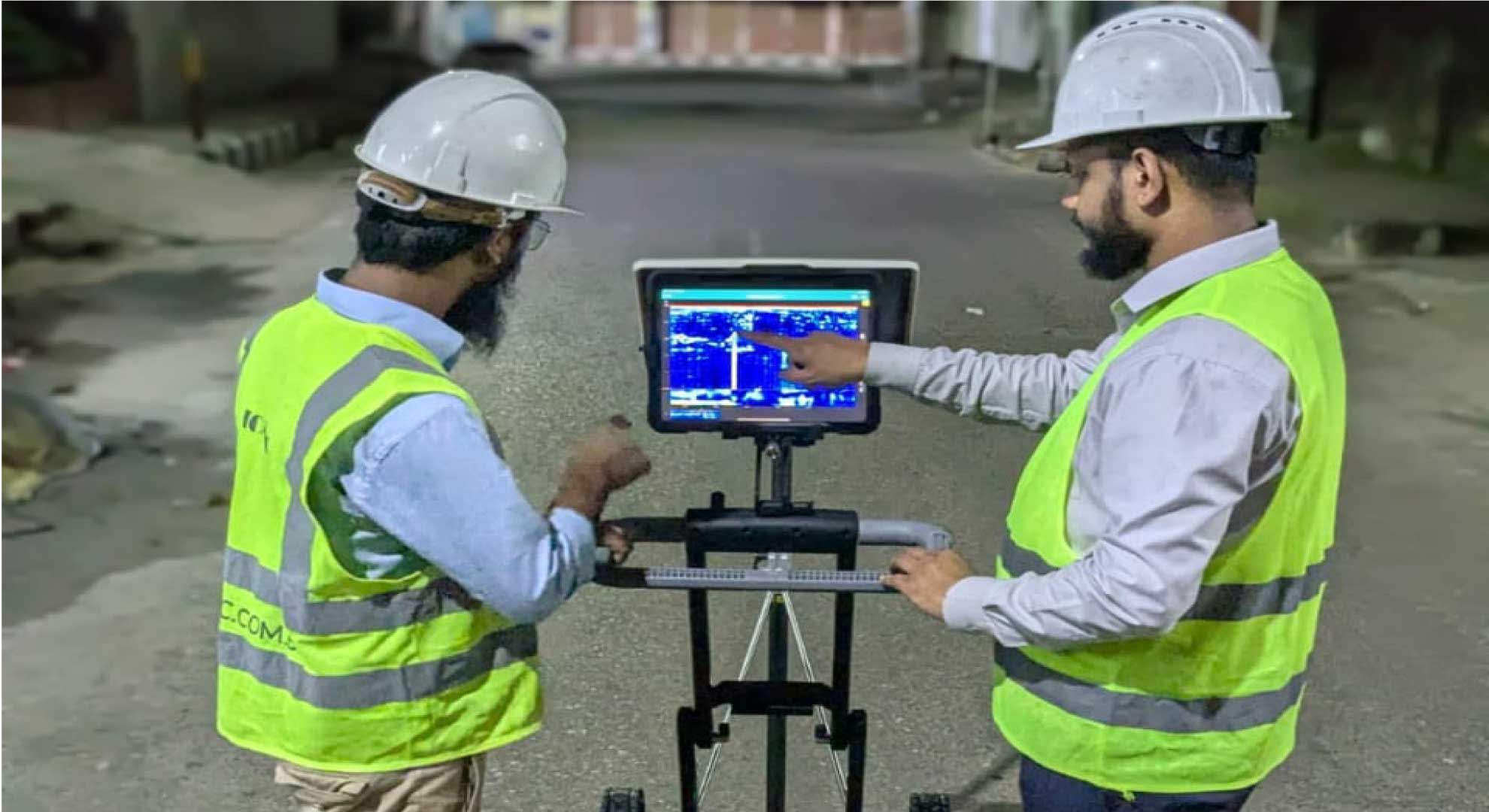
Subsurface utility mapping refers to the process of identifying, mapping, and documenting underground utilities such as water pipelines, gas lines, electrical cables, and fiber optics. This process leverages advanced technologies to provide precise data for construction, excavation, and maintenance work.
The Importance of Subsurface Utility Mapping
- Enhances Safety: Prevents accidental utility strikes that can lead to hazardous conditions.
- Reduces Costs: Avoids costly repairs and project delays due to utility damage.
- Improves Planning: Provides accurate utility data for better infrastructure design and execution.
- Regulatory Compliance: Ensures adherence to legal requirements and safety standards.
- Environmental Protection: Minimizes risks of leaks and contamination from damaged utilities.
Technologies Used in Subsurface Utility Mapping
Several advanced technologies contribute to effective subsurface utility mapping:
Ground-Penetrating Radar (GPR)
- Uses radar pulses to detect underground utilities.
- Provides high-resolution images for accurate mapping.
Electromagnetic Locators (EML)
- Identifies metallic utilities through electromagnetic signals.
- Useful for mapping power lines and pipelines.
LiDAR (Light Detection and Ranging)
- Captures detailed surface and underground data.
- Enhances precision in utility mapping projects.
Geographic Information System (GIS)
- Integrates mapping data with digital records.
- Helps create comprehensive utility maps for future reference.
Hydro Vacuum Excavation
- Non-destructive digging method for confirming utility locations.
- Prevents damage while ensuring accurate mapping.
Benefits of Using Subsurface Utility Mapping Solutions
- Minimizing Construction Delays: Accurate utility mapping helps avoid unexpected obstructions, keeping projects on schedule.
- Improved Worker Safety: By knowing the exact locations of underground utilities, workers can perform tasks safely, reducing accidents.
- Enhanced Project Planning: Engineers and planners can design infrastructure projects with confidence, reducing design errors and costly revisions.
- Lower Operational Costs: Preemptive mapping reduces the financial burden of utility damages and legal liabilities.
- Future-Proofing Infrastructure: Maintaining an updated utility map ensures future developments can proceed without major obstacles.
Applications of Subsurface Utility Mapping
- Urban Development Projects – Helps city planners efficiently lay out underground utilities for smart cities.
- Transportation Infrastructure – Aids in road construction and railway projects by ensuring clear underground pathways.
- Oil and Gas Pipelines – Reduces risks associated with pipeline leaks and maintenance operations.
- Telecommunications Expansion – Ensures proper fiber optic and communication cable placement.
- Water and Sewage Management – Improves pipeline maintenance and prevents water contamination.
Challenges in Subsurface Utility Mapping
Despite its advantages, subsurface utility mapping presents challenges such as:
- Data Accuracy Issues: Inconsistent historical utility records can impact mapping precision.
- Technological Limitations: Certain soil conditions may reduce the effectiveness of GPR and other methods.
- Regulatory Hurdles: Compliance with different regional regulations can complicate the mapping process.
- Cost Constraints: Advanced mapping technologies may be expensive for smaller projects.
Best Practices for Effective Subsurface Utility Mapping
- Use Multiple Mapping Techniques: Combining GPR, EML, and GIS improves accuracy.
- Regularly Update Utility Records: Keeping records up to date ensures better future planning.
- Collaborate with Utility Providers: Working with utility companies enhances data reliability.
- Train Field Personnel: Skilled professionals ensure effective data collection and interpretation.
- Adopt a Proactive Approach: Conduct utility mapping before excavation to avoid disruptions.