Remote Sensing and Observation Systems are important parts of modern technology, which are used to collect and observe various information about the Earth and space. They use satellites, drones, or other devices that are located at great distances from Earth. Through this, we can collect information about different places on the Earth, which is used in various fields such as environment, agriculture, weather, urban planning, and military purposes.
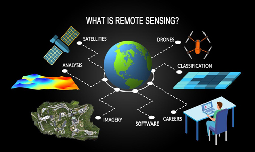
What is Remote Sensing?
Remote sensing refers to the collection of information on the Earth or any other planet by a system or device, where the sensor is not in direct contact with the target. Through this, we collect a type of data or image, which is used for further analysis and research. The two main components of remote sensing technology are passive sensing and active sensing.
- Passive Sensing: It collects reflected or heated rays from sunlight. For example, determining the condition of crops or the amount of rain from the sky.
- Active sensing: This system collects their reflection by sending its own electric or radio waves. For example, analyzing rainfall or landforms using radar.
Uses of remote sensing technology
- Agriculture: Farmers can monitor the condition of the land, crop growth, soil moisture, etc. through remote sensing. This makes it possible to predict crop diseases, insects or drought.
- Environment: To protect the environment, remote sensing helps track various types of environmental changes. Loss of forest areas, increase or decrease in water levels of rivers or oceans, air pollution, etc. can be recorded.
- Urban planning: It is possible to plan better cities by observing the growth of cities, construction of buildings, construction of roads, etc. In addition, emergency measures can be taken in the event of earthquakes, floods or other natural disasters.
- Weather forecasting: Remote sensing technology is used to analyze weather conditions. It provides important information related to rainfall, temperature, wind movement, etc., which helps in making accurate weather forecasts.
Observation System
An observation system refers to the device or process used to observe and analyze various aspects of the Earth or space. This system usually uses technology like satellites or drones, which observe outside or below the Earth’s atmosphere. Through this system, an idea can be obtained about the earth’s oceans, coastal areas of the land, atmosphere and other natural or man-made changes.
Remote sensing and observation system is a very important technology in collecting information about the earth and space. With the help of this technology, we can know better about our environment, agriculture, cities and weather and be able to make important decisions from it. In the future, this technology will be further developed and will open new horizons in various areas of our lives.